


|
Blood River Bottoms Wildlife Management Area |
|
A tract of Kentucky Lake Wildlife Management Area |


|
Directions to Blood River Bottoms WMA |
|
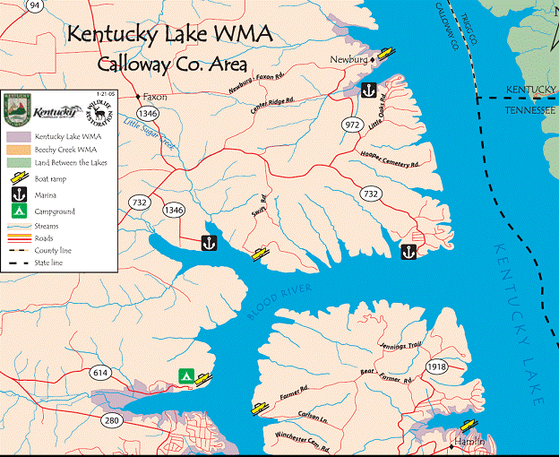
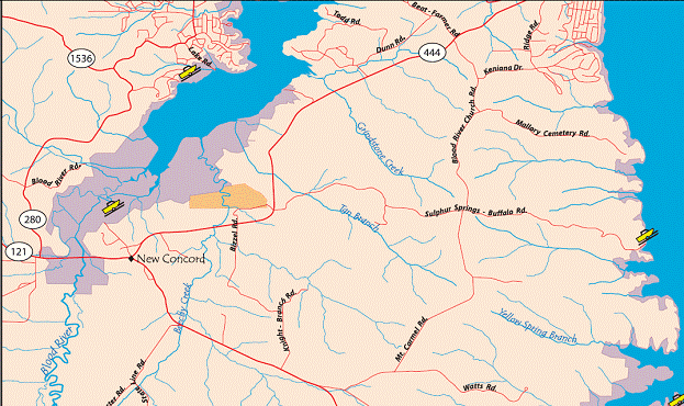
Blood River Bottoms Wildlife Management Area is located at the intersection of Highway 121 and Highway 280 in New Concord, Kentucky.
Parking is permitted on the side of all county roads as well as via two access roads. One access road is located on Hwy 121, east of the intersection of Hwy 280 and Hwy 121 on the left. Look for a brown sign on the right that reads “Blood River Bottoms Wildlife Management Area.” Another access road is located on Deerberry Lane, which is found by heading north on Hwy 280 from the intersection of Hwy 121 and Hwy 280. Deerberry Lane will be on your right.
GPS Coordinates for the public access road on Hwy 121 are (36.548339,-88.167007). The public access road on Deerberry Lane is located at (36.561968,-88.174986).
Maps are located below, with Blood River Bottoms WMA circled in green: |

|
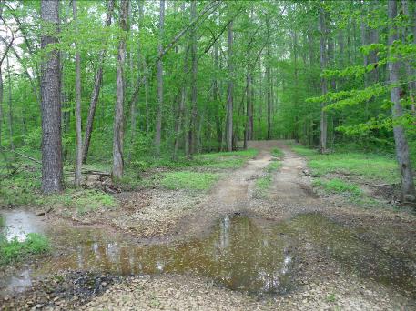
Access road - located off Highway 121 in New Concord, KY. Access road is labeled by brown “Blood River Bottoms Day Use Only” signs located on either side of the highway. |
